The Elements of Innovation Discovered

Exyn drones map Alaska, BC gold mines

Northern Star, Ascot are early adopters of cutting-edge tech Metal Tech News – February 19, 2022
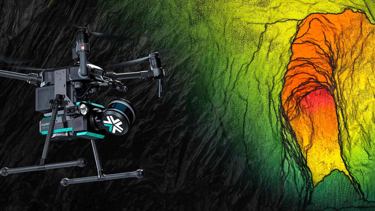
Whether exploring and mapping a historical underground mine for the first time since it was shuttered during World War II or generating more detailed maps of a modern operation, drones that navigate the labyrinth of ramps, declines, stopes, and other underground environs without reliance on the global positioning system or human guidance can make subterranean mine surveying safer, faster, and more accurate.

Ascot Resources Ltd. and Northern Star Resources Ltd. are amongst the first to leverage the benefits that come with the award-winning underground mapping systems developed by Exyn Technologies Inc., a pioneer of aerial drones capable of autonomously navigating and mapping complex subterranean environments beyond the reach of GPS.

While both mining companies were amongst the earliest adopters of Exyn Technologies, their reasons were quite different and underscore the power and wide applications of a system that combines artificial intelligence, autonomous flight, and lidar to navigate and map underground mines.

Ascot utilized Exyn drones to safely investigate and map the historical Missouri Ridge underground mine at its Premier gold-silver project in British Columbia's Golden Triangle.

Northern Star leveraged Exyn's aerial and mining equipment-mounted systems to quickly and safely create the most detailed maps ever generated of all the underground passages at its active Pogo gold mine in Alaska.

Though their objectives were different, both companies were able to quickly gain a better understanding of the underground workings at their gold-rich northern projects without putting people in harm's way, which may be the most important advantage offered by Exyn's technology.

"It is always easier to lose a robot than it is to lose a person and we are happy to make the technology available for those purposes," Exyn Technologies Chief Technology Officer Jason Derenick told Mining News.

Award-winning technology

Exyn, which is mapping new frontiers when it comes to autonomous drones that rely on their own sensors and AI to navigate, has found an ideal home for its avant-garde technology at underground mines.

Last year, Exyn drones were the first in the world to achieve Level 4 autonomy, which means the drone is able to carry out its preprogrammed mission by determining its own points of interest without further human input; sense and navigate obstacles with onboard sensors to detect the environment in 3D, allowing underground exploration without GPS; detect and avoid obstacles; and collect the data it was programmed to retrieve.

"Our systems are not only the most sophisticated available commercially worldwide, but the unique capabilities we possess are fundamentally necessary for safe and successful operation in the most challenging of environments," said Exyn Technologies CEO Nader Elm.

This level of autonomy and sophistication is so powerful that it piqued the interest of Sandvik Mining and Rock Solutions, a global supplier of underground mining equipment and advanced systems for autonomous and remote operations of equipment.

In 2020, Sandvik entered into a partnership with Exyn that is merging their technologies into autonomous underground mining equipment that do not need GPS or even a wireless underground telecommunications network to self-navigate subterranean environs.

"This partnership will open up unique benefits, build on our industry leading automation offering and drive faster decision-making in mining processes to seize new opportunities for improving production performance," Patrick Murphy, president of rock drills and technology at Sandvik Mining and Rock Solutions, said at the time.

Over the nearly two years since this partnership was forged, Sandvik has incorporated Exyn's mapping and guidance technology into an autonomous concept vehicle that may offer a glimpse into the fully autonomous future of underground mining equipment.

"This latest concept is a glimpse at a future where mine workers no longer need to go underground to maintain mining operations," Raffi Jabrayan, vice president of commercial sales and business development at Exyn Technologies, told Mining News.

With an Exyn drone piggybacked on a wheeled Sandvik autonomous vehicle, this underground mine mapping and inspection concept vehicle is the latest innovation to come out of the partnership between these innovative companies.

"With a robust autonomous robotic collaboration, dangerous underground cavities can be mapped safely and efficiently while high fidelity data sets can be immediately uploaded to production mining software," said Jabrayan.

Further details of the concept vehicle being developed under the Exyn-Sandvik partnership can be read at Charting new mining robotics territory in the September 20, 2021 edition of Metal Tech News.

Premier testing ground

Where Sandvik is implementing Exyn's advanced technologies into the future of mining robotics, Ascot Resources used the drones to peer into the past by investigating underground mine passages that have not been seen since the 1940s.

Ascot got the idea of using Exyn drones while gathering the final information it would need to put together a feasibility study that details a plan for reestablishing a mine at its Premier gold-silver project near Stewart, BC. This plan includes mining ore left behind during the historical operations at Big Missouri.

While drilling carried out by Ascot had established that a rich deposit of gold and silver remained, the company only had historical hand-drawn maps of the underground mines at Big Missouri.

A modern investigation and accurate 3D model of historical underground passages would help provide Ascot with a much better idea of how much of the resource remained and also assist engineers with planning a modern underground mine to extract those resources.

The problem, however, was the 80- to 100-year-old underground passages at Big Missouri were too dangerous for humans to explore and too small for most modern machines.

In addition to the risks, traditional mapping takes a lot of time, and the accuracy of the survey can easily be skewed due to carrying a traverse from a control point at the surface – even the smallest inaccuracies along the survey route can multiply as you get deeper into the mine.

Looking for a way to map the narrow underground passages dug out by miners nearly a century earlier, Ascot turned to Exyn and its drones.

"It was a very natural partnership," Exyn's Derenick told Mining News.

Equipped with a drone and other equipment, a team from Exyn was able to quickly and accurately map the Big Missouri underground mine.

With the surveyors stationed near the surface, the autonomous Exyn drone was able to scan stopes in two-to-three minutes and collect more than 20 million points of data in real-time, capturing a highly accurate view of the underground voids.

"At Ascot we are looking to use the facilities available at a former producing mine to extract new resources that we are currently drilling," Ascot Resources COO John Kieran said at the time. "Exyn came to our site to show us the autonomous capabilities of their drone technology, and we're very impressed with the timeliness and quality of the data acquired."

With the help of that data, Ascot completed a feasibility study in 2020 that envisions four mines in the Stewart area – Big Missouri, Silver Coin, Premier, and Red Mountain – producing roughly 1.1 million ounces of gold and 3 million oz of silver over an initial eight years of mining.

Ascot expects to begin underground development at Big Missouri, the first deposit to be mined at Premier, in April. The first gold produced from a modern version of this historic mine surveyed by Exyn is expected by early 2023.

"We are excited to get the Premier mill restarted with first gold pour anticipated around this time next year," Ascot Resources President and CEO Derek White said in January.

For Exyn, the Big Missouri survey marked the first time its autonomous flight and mapping technology was used in an abandoned mine.

"That type of experience is invaluable, especially when it comes to the sorts of development we are doing because a lot of it is very much cutting-edge," Derenick said.

And it also proves that Exyn's cutting-edge autonomous aerial vehicles can provide mining and exploration companies with a means of rapidly, accurately, and safely mapping long-abandoned underground mines with valuable ore that can be economically and sustainably recovered with modern mining techniques.

Detailed mapping of Pogo

Northern Star has found that the same speed, accuracy, and GPS-free navigation that makes Exyn drones an important vehicle for mapping long-abandoned underground mines is invaluable to currently producing operations.

Just like historical mines, modern underground operations rely on a GPS accessible control point to be established at the surface and then a survey is carried into the depths of the mine.

Northern Star, which acquired Pogo at the end of 2018, was unsure of the accuracy of the underground surveys at its Alaska gold mine. With this potentially creating a problem for deposit modeling and mine planning, the Australia-based mining company wanted to complete a new survey of the many miles of underground passages at Pogo.

"They were not entirely confident in their control points, so they were looking for an accurate, easy, and rapid way to survey this mine – that is where our technology was a great fit for them," Jack Gentry, an Exyn Technologies field engineer that went to Pogo during the initial remapping of the mine.

To carry out the resurvey, Northern Star utilized ExynAero, the most advanced version of Exyn drones, and ExynPak, a handheld version of the company's mapping system that can be mounted on vehicles.

Working in combination, the vehicle-mounted ExynPak mapped out the underground drifts while the ExynAero drone mapped out the active stopes, quickly providing Northern Star with an accurate map of its Pogo underground mine.

Jim Coxon, Northern Star Resources Vice President of Operations, North America, says the quality of the data collected by the Exyn systems is exceptional.

Northern Star was so impressed with the Exyn technology that the mining company purchased two of its ExynAero drones to continue mapping the new ramps, drifts, and stopes it develops to feed high-grade gold ore into the recently expanded and upgraded mill at Pogo.

Coxon says these new drones have replaced the old method of surveying newly created stopes – voids that typically are roughly 85 feet long, 45 ft high, and 9 ft wide – that are non-entry areas until they are fully assessed.

Previously, such scans were conducted with a scanner mounted on a long pole and pushed into the stope. Now an Exyn drone can more safely and easily provide a more detailed picture of the new stope.

"The drone is able to scan all parts of the mining void in a lot more detail, it almost seems like you are looking at a photo of the mining void," the Northern Star executive told Mining News in an email. "This detail provides accurate void information and allows the interpretation of geological features within the void."

This level of detail is allowing Pogo mine planning teams to immediately and accurately begin designing new underground development and blast holes around the new voids.

With all the safety, quality of data, and production advantages offered by Exyn drones, this technology has become the modus operandi for underground mine surveys at Pogo, and Northern Star is adopting similar technologies at its gold mining operations in Australia.

As for Exyn, the AI-powered mapping drones nor the Sandvik concept vehicle mark the pinnacle of the technologies it plans to offer. For now, however, the next generation of mining technologies remain under wraps.

"We certainly have a lot of things coming down the pipe – stay tuned," Exyn's chief technology officer told Mining News.

EDITOR'S NOTE: This article was originally published in the February 18, 2022 edition of North of 60 Mining News, a sister publication to Metal Tech News that covers mining and mineral exploration in Alaska, Northern British Columbia, and the Canadian territories.

Author Bio

Shane Lasley, Metal Tech News

Author photo

With more than 16 years of covering mining, Shane is renowned for his insights and and in-depth analysis of mining, mineral exploration and technology metals.


Reader Comments(0)